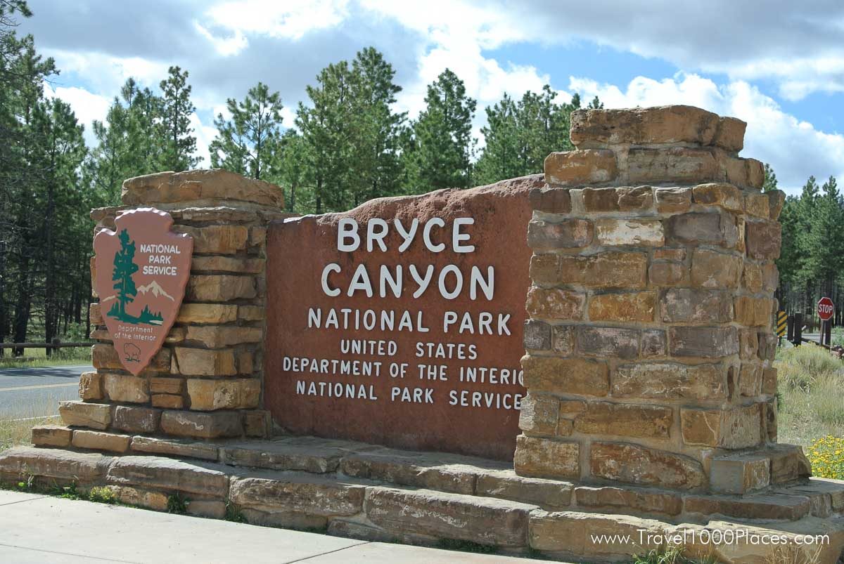
The park was named after the Mormon Pioneer Ebenezer Bryce – Bryce Canyon became a National Park in 1924.
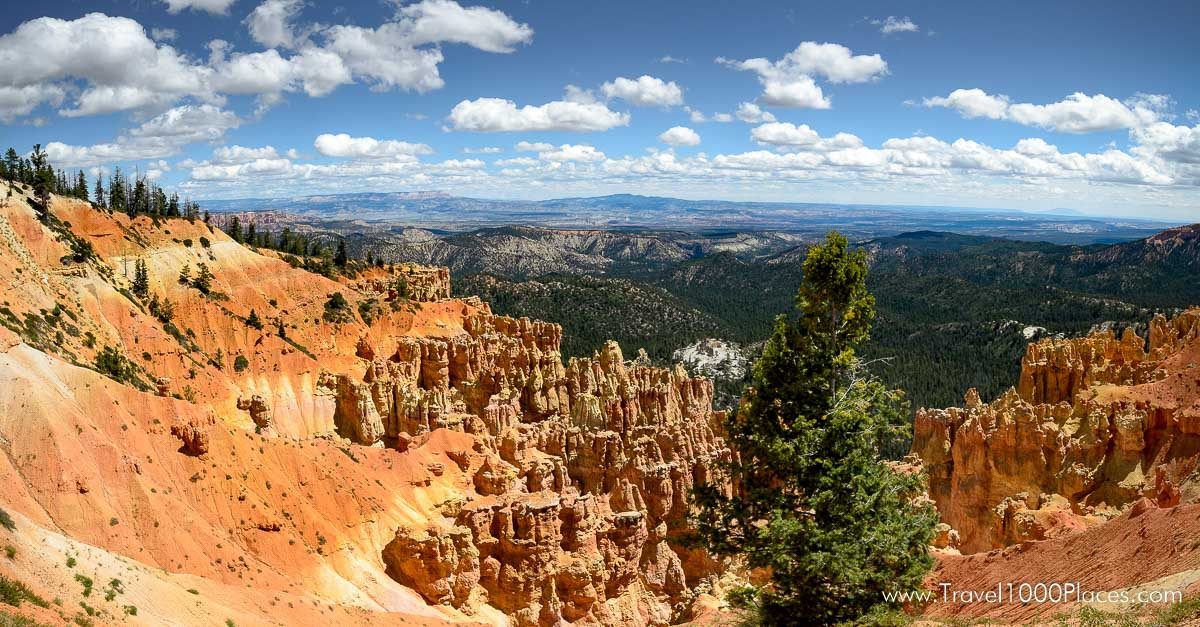
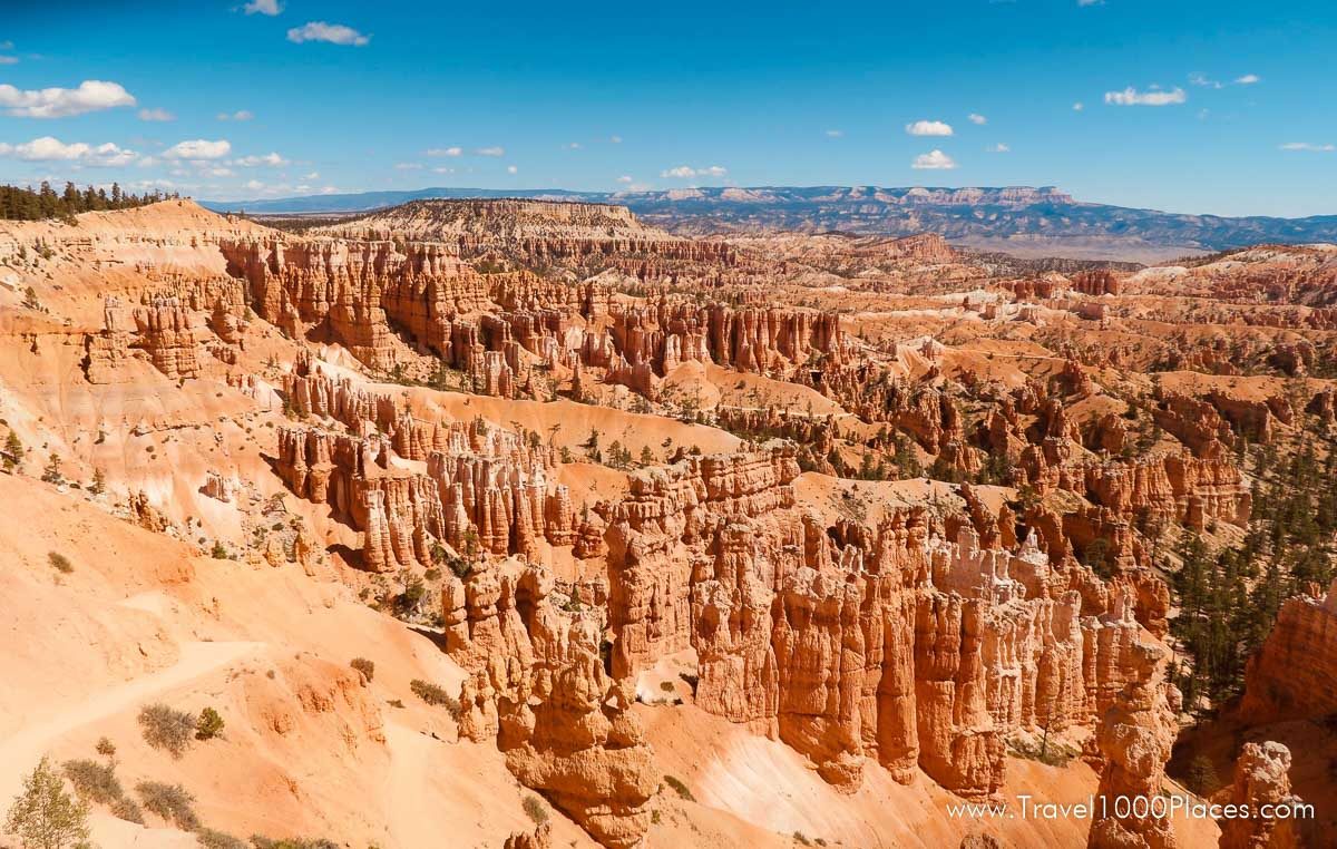
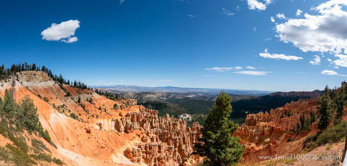
Because Bryce transcends 2000 ft. (650 m) of elevation, the park exists in three distinct climatic zones: spruce/fir forest, Ponderosa Pine forest, and Pinyon Pine/juniper forest. This diversity of habitat provides for high biodiversity. Here at Bryce, you can enjoy over 100 species of birds, dozens of mammals, and more than a thousand plant species. It is the uniqueness of the rocks that caused Bryce Canyon to be designated as a national park. These famous spires called “hoodoos” are formed when ice and rainwater wear away the weak limestone that makes up the Claron Formation.
Many do like the park even more than Grand Canyon. May be because Bryce Canyon is more accessible, that means more handy or may be because of the hoodoos.
Where is the best overlook?
There are 14 viewpoints along Bryce Canyon’s 18-mile scenic drive (one-way distance) and everybody determines his or her favorite for a multitude of reasons. Furthermore, for every 15 minutes you extend your visit, you can see another overlook. If you stop at all the viewpoints, it could take as little as 3-4 hours.
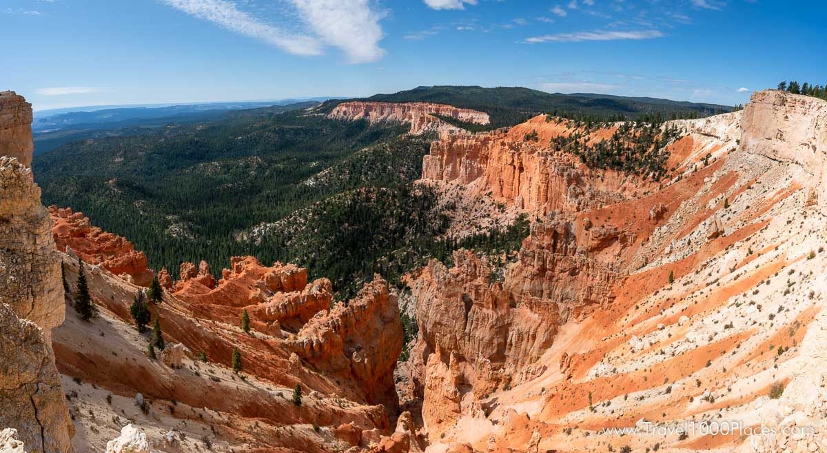
Our most famous views are found in Bryce Amphitheater, including Sunrise, Sunset, Inspiration and Bryce Points. The southern overlooks feature long-distance, panoramic views across the Grand Staircase-Escalante National Monument.
Since all the viewpoints are on the left side of the road as you drive south towards Rainbow Point, we recommend stopping at the viewpoints as you drive north on your return trip. This way, each stop will be an easy and safe right turn.
Must See’s
Park Road
To drive this loop takes approx. 3 hrs provided you stop at the view points.
The National Park Service Rangers encourage visitors to start the auto tour of Bryce Canyon National Park by driving directly to the very southern end first.
Before leaving the Rainbow Point area make sure you walk to the southern overlook — Yovimpa Point. Here is one of the places you can get a good look at the sequence of rock layers called the Grand Staircase.
From here make your way north and enjoy the phantastic views.
Along the park road
Natural Bridge
Though the name tends to be misleading, Natural Bridge is one of several natural arches in Bryce Canyon and creates a beautiful scene at this viewpoint. This arch, sculpted from some of the reddest rock of the Claron Formation (rich in iron oxide minerals), poses a stark contrast to the dark green of the Ponderosa forest that peeks through the arch from the canyon below.
Paria View
Photographers seeking sunset pictures are often disappointed by that fact that most of cliffs and hoodoos of Bryce Canyon do not face the setting sun. Paria View is one exception. Here one prominent and photogenic castle-like hoodoo rises high above the canyon floor to absorb the last rays of the setting sun. Paria is a Paiute word meaning “water with Elk” or “water with mud” the translation varies depending on context and season of the year.
Bryce Point
From Bryce Point, one of the most scenic vistas of the full amphitheater and all its wonders amaze the visitor. Bryce Point is famous for its extraordinary sunrises. From here you can watch the tops of hoodoos set alight as if by fire from the first rays of the rising sun. Like fire the orange light quickly spreads driving shadows from all but the deepest recesses of the amphitheater.
Inspiration Point
The viewpoint at Inspiration Point consists of three levels that provide varied spectacular perspectives of the main amphitheater. From here, visitors look toward the Silent City (near Sunset Point) with its many rows of seemingly frozen hoodoos set against the backdrop of Boat Mesa. All who look out from this point are bound to be inspired, considering the intricacies of the hoodoos and their formation through the erosion of the Claron Formation.
Sunset Point
Sunset Point offers vistas of some of the most famous and breathtaking of Bryce Canyon’s hoodoos. Directly below the point and to the south, the Silent City rises from the canyon floor, a maze of hoodoos and fins packed in tight formation. Just below the overlook on the northern edge, Thor’s Hammer stands alone. Striking in form due to its isolation from other hoodoos, Thor’s Hammer is a favorite among visitors.
The Navajo Loop Trail descends from Sunset Point through the slot canyon of Wall Street, where a 450-year-old Douglas-fir reaches upward toward the sunlight at the top of the canyon. The Navajo Loop is the most popular trail in the park, and is often combined with the Queen’s Garden Trail to form a longer loop that passes through the Queen’s Garden and emerges onto the rim at Sunrise Point.
Sunrise Point
The view to the northeast from Sunrise Point captures Boat Mesa and the Sinking Ship, set against the stark Pink Cliffs of the Aquarius Plateau. Boat Mesa, capped by the resistant rock called “The Conglomerate at Boat Mesa,” rises above the hoodoos of Fairyland Canyon to an elevation of 8073 feet.
Sunrise Point serves as the trailhead for the easy to moderate Queen’s Garden Trail that descends into a section of hoodoos ruled by the Queen Victoria hoodoo.
Fairyland Canyon
Fairyland Canyon, located one mile north of the National Park entrance station, offers an opportunity to hoodoos at an “eye-to-eye” level. These hoodoos have inspired imaginations for years, and visitors today are bound to be as enchanted as were the Paiute Indians, who saw the hoodoos as ancient peoples turned to stone.
Mossy Cave
Mossy Cave is truly a must see stop. Mossy Cave is in the northern section of the park, located on highway 12, approximately 4 miles east of the intersection of highways 12 and 63. Look for a small parking area on the right-hand side immediately after crossing a little bridge. The Mossy Cave itself is at the end of short trail. Here to you can see hoodoos and windows without having to hike a steep trail.
Hikes
There are many hiking options and depending on your fitness and according to your goals you can select a trail: go online for orientation and descriptions or get a map at the visitor center / entry station when you arrive at Bryce Canyon.
Day Hikes in Bryce Amphitheater:
The easiest trail is the 1/2-mile (one way) section of Rim Trail between Sunset and Sunrise Points. Other sections of the Rim Trail (which extends 5.5 miles / 9.2 km between Fairyland and Bryce Points) have steeper terrain.
Day-hiking trails at Bryce Canyon include:
- Upper Inspiration Point (.3 miles / .5 km round trip)
- Mossy Cave (.9 miles / 1.5 km round trip)
- Bristlecone Loop (1.0 miles / 1.6 km round trip)
- Navajo Loop (1.3 miles / 2.2 km round trip)
- Queen’s Garden/Navajo Loop Combination (2.9 miles / 4.6 km round trip)
- Tower Bridge (3 miles / 4.8 km round trip)
- Hat Shop (4 miles / 6.5 km round trip)
- Swamp Canyon Loop (4.3 miles / 7.2 km round trip)
- Peekaboo Loop (5.5 miles / 8.8 km round trip)
- Fairyland Loop (8 miles / 12.9 km round trip)
- Riggs Spring Loop (8.5 miles / 14.2 km round trip)
- The Peekaboo Loop Trail also serves as a horse trail.
Camping
Bryce Canyon National Park has two campgrounds located in close proximity to the Visitor Center, Bryce Canyon Lodge and the geologic wonder that is the Bryce Amphitheater. Both have restrooms with flush toilets, and drinking water.
NORTH CAMPGROUND (Open year round)
North Campground is located opposite the Bryce Canyon Visitor Center and has 107 sites in 4 loops.
SUNSET CAMPGROUND (Closed in winter)
Sunset Campground has 101 sites available on a first-come, first-served basis; NO RESERVATIONS ARE ACCEPTED. Located opposite Sunset Point approximately 1.5 miles south of the Bryce Canyon Visitor Center. Reservations online: see further down the website of: National Recreation Reservation System (NRRS)
For the most accurate and up-to-date information and reservations please visit the official park website: https://www.nps.gov/brca/planyourvisit/campgrounds.htm
Camping outside of the park
Very close to the entrance of Bryce Canyon National Park is Ruby’s Inn Lodge which has a very nice and large campground for RV’s as well as tents. Many trees, a General Store, Showers, Toilets are some of the amenities. Website Ruby’s Inn RV and Campground
Lodging
Bryce Canyon Lodge is directly inside the Park (https://www.brycecanyonforever.com/) and Best Western Ruby Inn (https://www.rubysinn.com/) is located at the entrance of the park. Other Hotels are 10-30 minute drives away.
Best time to travel / Season
The main travel season for South Utah in general is the summer! Highest temperatures can be expected during these months as well as high prices for accommodation. Best time to travel is late spring and early fall when temperatures are moderate and the park is not crowded.
Park elevations reach 9,100 feet (2778 meters). People with heart or respiratory problems should be especially careful not to overexert themselves. Winters are typically long and cold, with an average of 96 inches of snow. Summers are mild and ideal for hiking and camping. The National Park Service recommends visiting Bryce in the “off-season.”
Sixty percent of the visitors come to Bryce Canyon June through September, but October through May is a fantastic time to enjoy the park. In fall and spring, there are fewer people, cooler temperatures, and spectacular fall foliage and wildflower displays. In winter, deep snow blankets the plateau and provides excellent cross-country skiing and snowshoeing opportunities. Bryce Canyon’s winter landscapes stagger the imagination, as dazzling white snow contrasts beautifully with crimson-colored hoodoos.
Climate and Temperatures
When visiting the park in July and August make sure to have enough water with you. Averages: January’s highs around 40 F (4 C)and lows around 9 F (-12 C). July/August’s highs around 80 F (27 C) and lows around 46 F (8 C).
Entrance fees
$35 per vehicle,
$30 per motorcycle
$20 Bicyclists, Walk-in (no car)
Entrance ticket valid for 7 consecutive days
Official park website: https://www.nps.gov/brca/
Tip: if you plan to visit 3-4 National Parks you should consider the Annual National Park Pass (for all parks) called America the Beautiful
