Whangarei is a good choice for staying overnight or even longer. The small city offers enough opportunities to keep a visitor busy and happy:
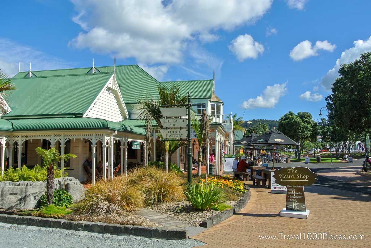
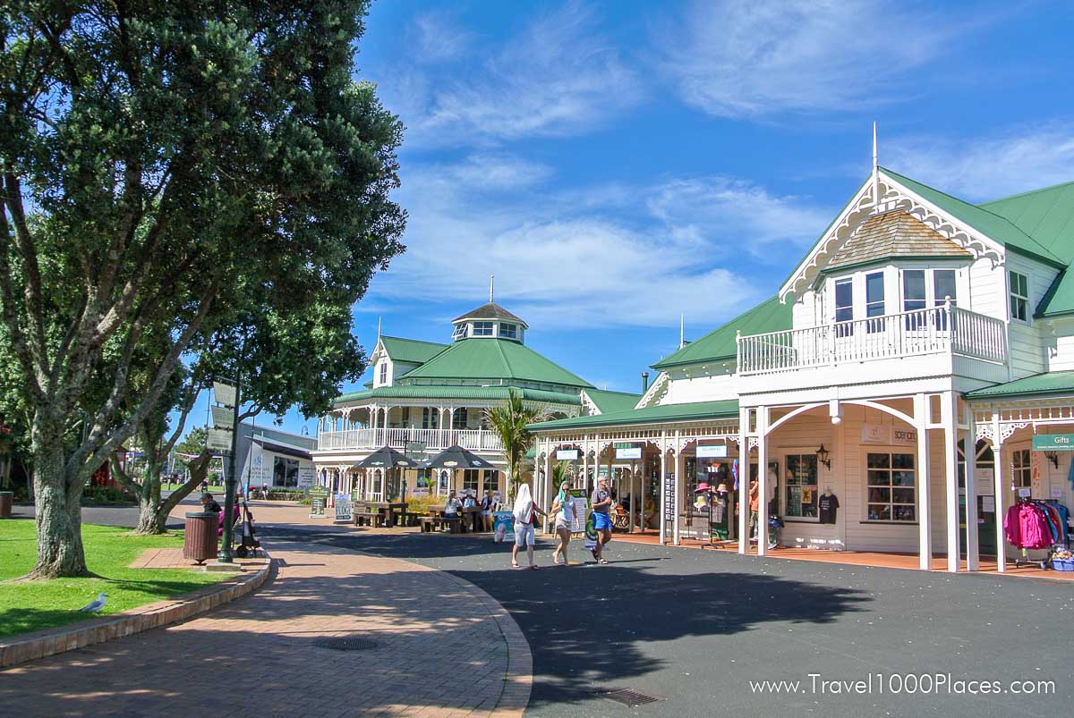
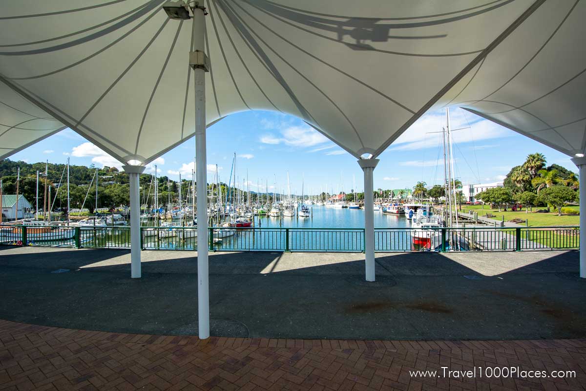
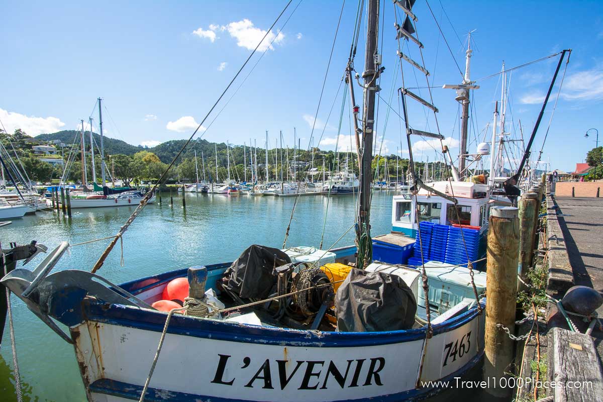
Town Basin (Quayside) invites to stroll along around visiting art galleries, a glass-blowing studio, the National Clock Musuem, or to shop in several specialty shops. Many restaurants and cafes contribute to the visitors culinary interests.
Longview Wine Estates is situated only 3 mi south of Whangerai on SH1 and is worth a visit if you like Cabernet Sauvignon, Merlot, Cabernet Franc, Malbec, Syrah, Chardonnay and Gewurztraminer. It is an award winning winery its Northland Merlot.
Zion Wildlife Gardens is a zoo renowned for its Lions, also White Lions.
Enjoy nature:
A H Reed Kauri Park Canopy Walkway
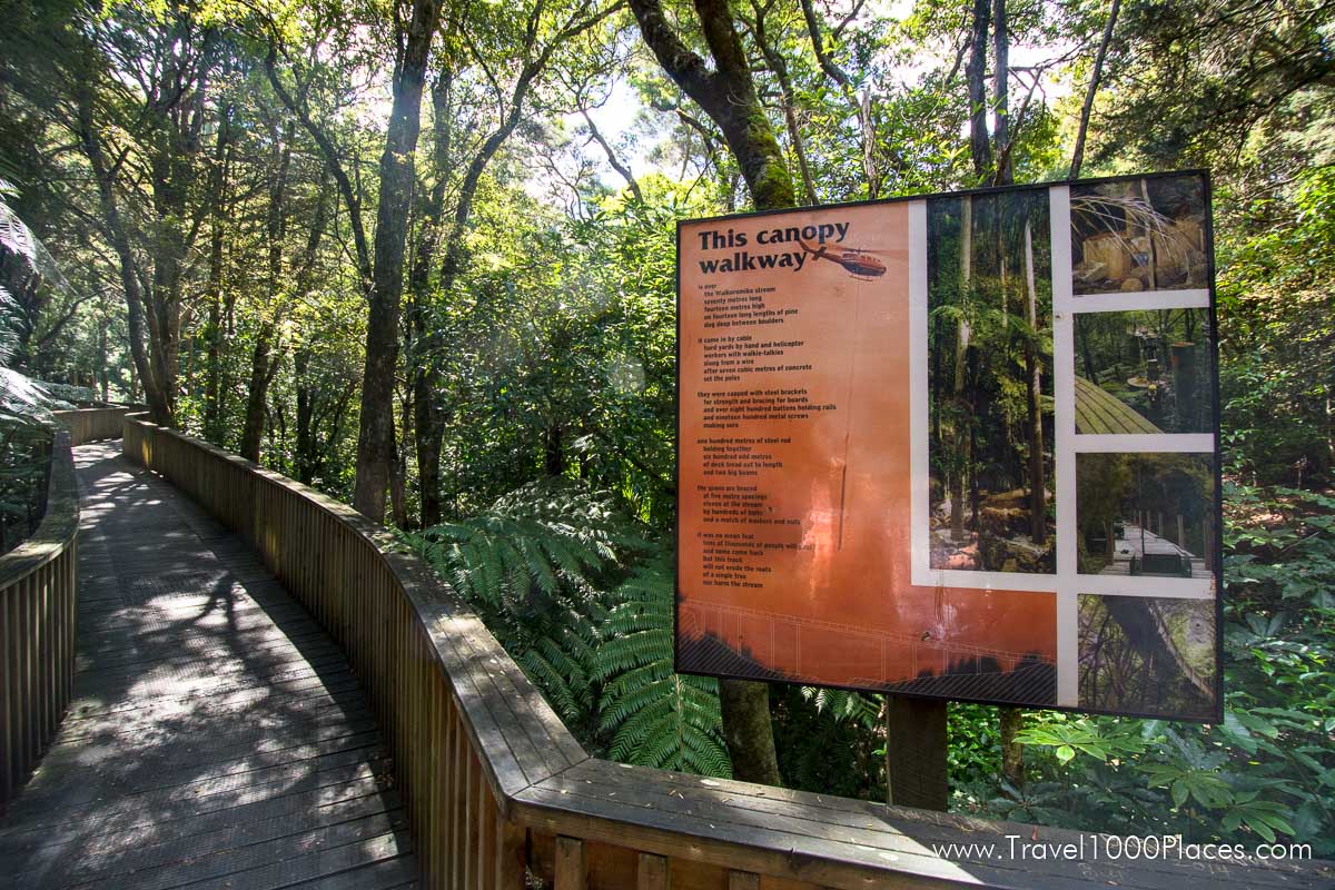
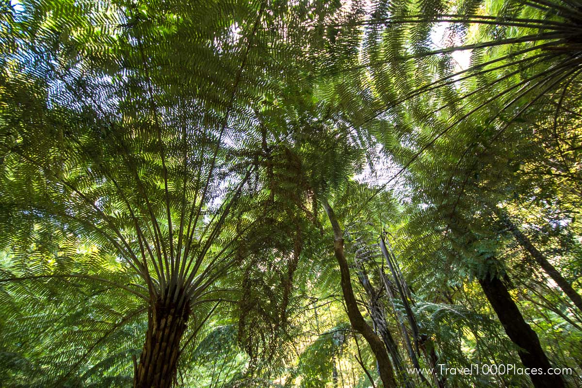
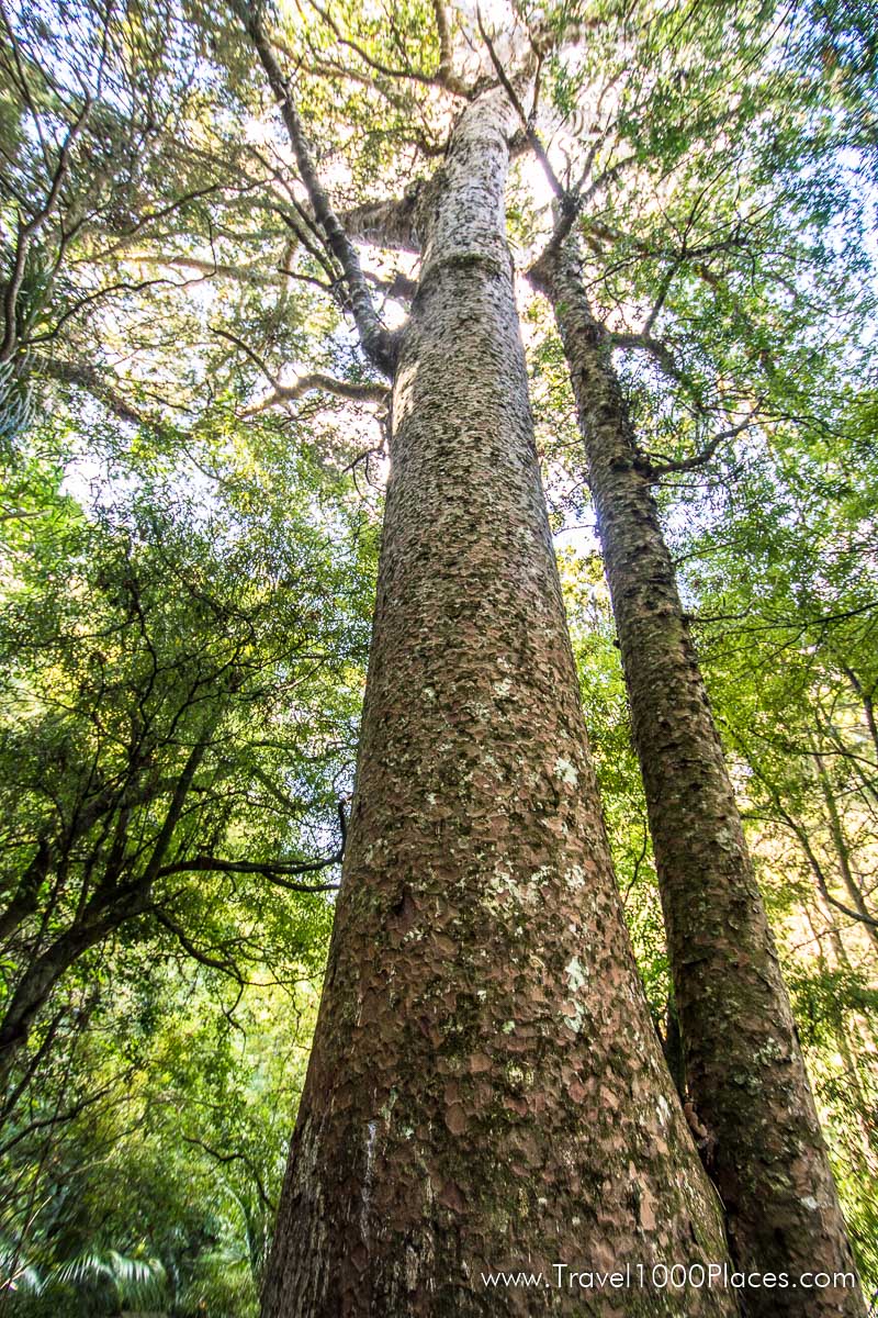
This bush is a magnificent remnant of the original Kauri Forests which were once extensive throughout Northland. The park features a canopy walkway giving a birds eye view of the forest, including two 500 year old Kauri trees. The walkway has been designed to provide access for wheel chairs. There are several other walkways within the park.
Another article: More places to see Kauri trees
Website: www.wdc.govt.nz/FacilitiesandRecreation/Parks/Pages/AHReedMemorialPark.aspx
Whangarei Falls
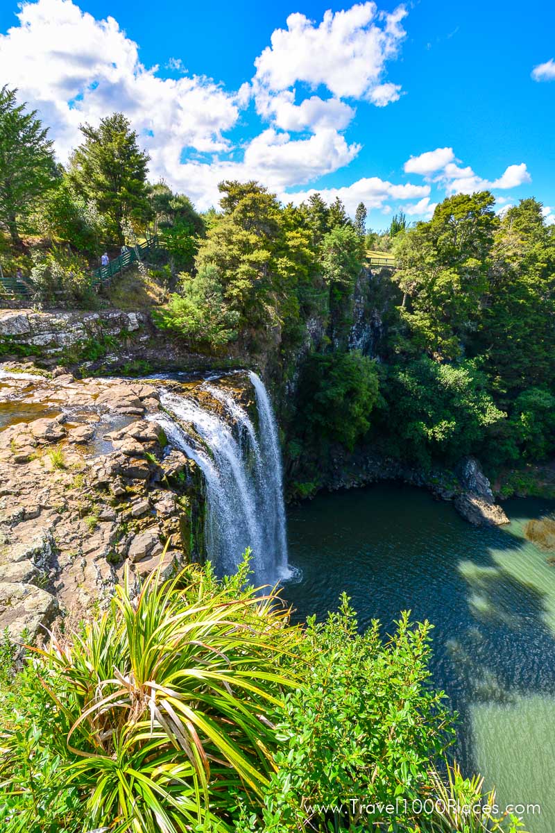
A must-see for visitors: Whangarei Falls is a picturesque waterfall, falling vertically for 26.3 metres over basalt cliffs. Three viewing platforms allow easy access to the dramatic views and a circular walk around the falls allows them to be seen from all angles.
Situated just 5 km northeast of Whangarei at Tikipunga. A short paved trail offers several great opportunities to take photographs from different perspectives.
Whangarei Falls Loop is officially rated Grade: 2 and takes approx. 30 minutes. Distance: 1 km. It is an easy, short trail.
The walk starts at the public car park and crosses the river above the waterfall via a metal bridge. The bridge has been designed for flood water to run over it and there is no hand rail. Some people may not feel comfortable using it.
The surfaced walkway continues through the reserve and down a flight of steps to the base of the falls where there is picnic table and viewing area. A bridge across the river leads to the walkway which zig-zags back up the hill through mature bush to the car park.
How to get to Whangarei Falls: From Whangarei, take Kiripaka Road (the road north) signposted to Ngunguru and Tutukaka. Whangarei Falls is signposted as you leave the suburb of Tikipunga. Turn right from Kiripaka Road into the entrance to the park where a public carpark and toilet facilities are available.
Website: www.wdc.govt.nz/FacilitiesandRecreation/WalksTrails/Pages/WhangareiFalls.aspx
Mount Parihaka
This ‘mountain’ offers the highest lookout point with 241 meters above Whangarei – enjoy the fantasic views over the city including Quayside and its yachts.
The summit of Mount Parihaka is a popular destination for it’s panoramic views over the city and the harbour. The viewing platform is next to a memorial to commemorate those lost in the two world wars.
How to get to Parihaka: Parihaka forms the eastern boundary of Whangarei city and is close to the city centre. The Dobbie and Drummond tracks can be reached from the Hatea Walkway where parking is available at Mair Park off Rurumoki Street.
The Ross Track can be reached via Dundas Road (junction with Riverside Drive) where there is some limited parking space. All three tracks can also be accessed from the car park at the summit of Parihaka, which is reached via Memorial Drive.
Website: www.wdc.govt.nz/FacilitiesandRecreation/WalksTrails/Pages/Parihaka.aspx
Mount Manaia
Also titled the castle rock because of its 5 castle-like peaks which sit approximately 460 meters above the entrance to Whangarei Harbour.
The Maori consider the peaks to be Chief Manaia, Pito (his wife and ex-wife of chief Hautatu), his two children and last but not least chief Hautatu in pursuit of his wife. When the God of Thunder judged them they were turned into stone.
The trails at Mount Manaia offer great views of the costline, islands, and the harbor.
Website: www.wdc.govt.nz/FacilitiesandRecreation/WalksTrails/Pages/MountManaia.aspx
