Throughout its 415 square miles of rock-ribbed wildness, Rocky Mountain National Park truly is a land of superlatives. Here, at least 60 mountains exceed 12,000 feet, topping off at 14,255 feet on the football field-sized summit of Longs Peak. Names such as Cirrus, Chiefs Head, Isolation, Mummy, and Storm evoke the grandeur of this high landscape.
In 1915, Congress created Rocky Mountain, the nation’s 10th National Park. Congress created the National Park Service in 1916.
The area now known as Rocky Mountain National Park has been occupied by human beings for 10,000 years. Archeologists have found more than 300 prehistoric sites at elevations ranging from 8,000 to 13,000 feet above sea level.
Although the great peaks comprise the essence of the park, the delicate alpine flowers, clear lakes, rushing mountain waters, and impressive forests appeal to all the senses. An array of wildlife – bighorn sheep, ptarmigan, coyote, elk – adds life to the landscape.
The wide variety of elevations and habitats create a choice of activities for visitors. From scenic dives and short strolls along a gentle trail to more ambitious daylong hikes to vertical mountain climbs, Rocky Mountain National Park offers many ways to experience nature in all its splendor.
The park roads are spectacular
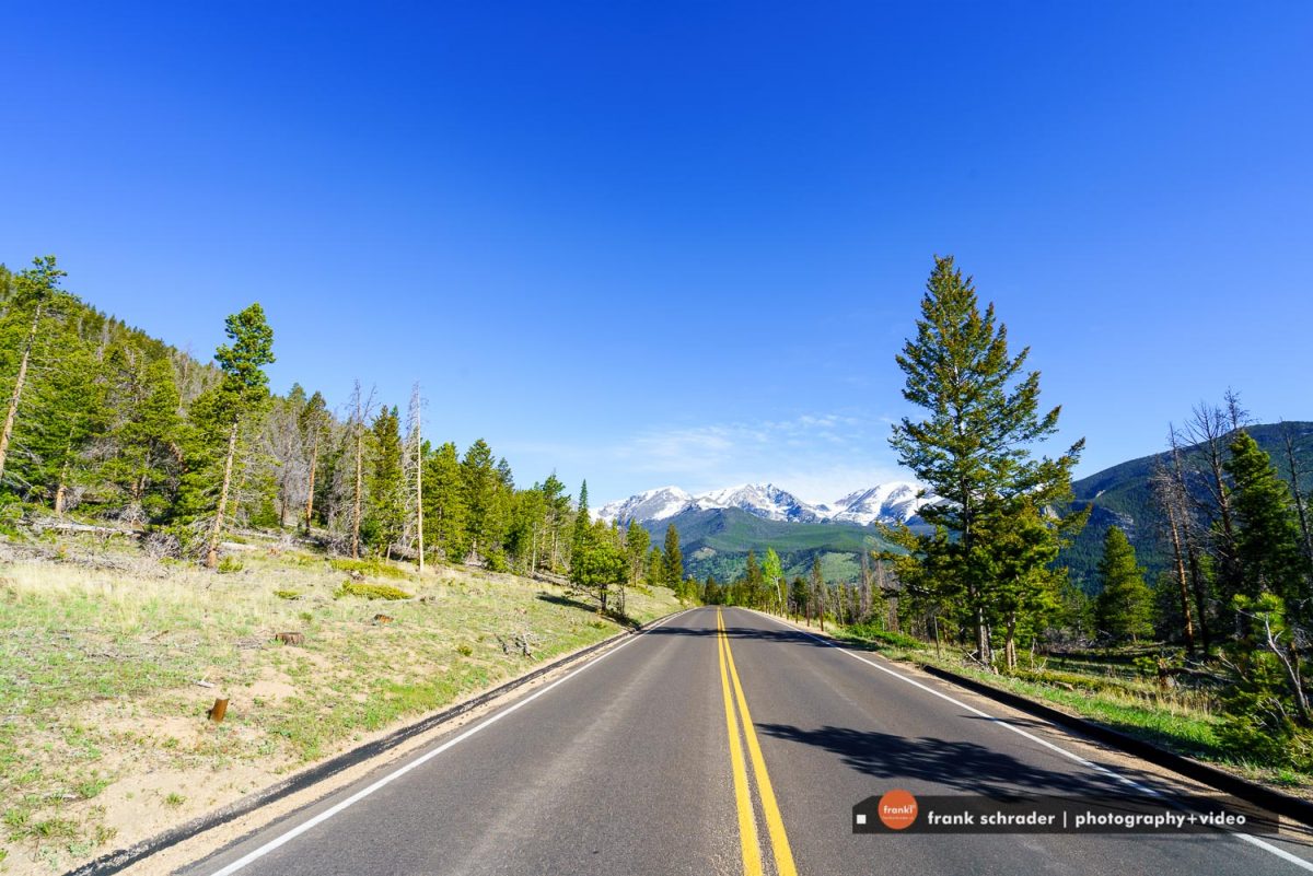
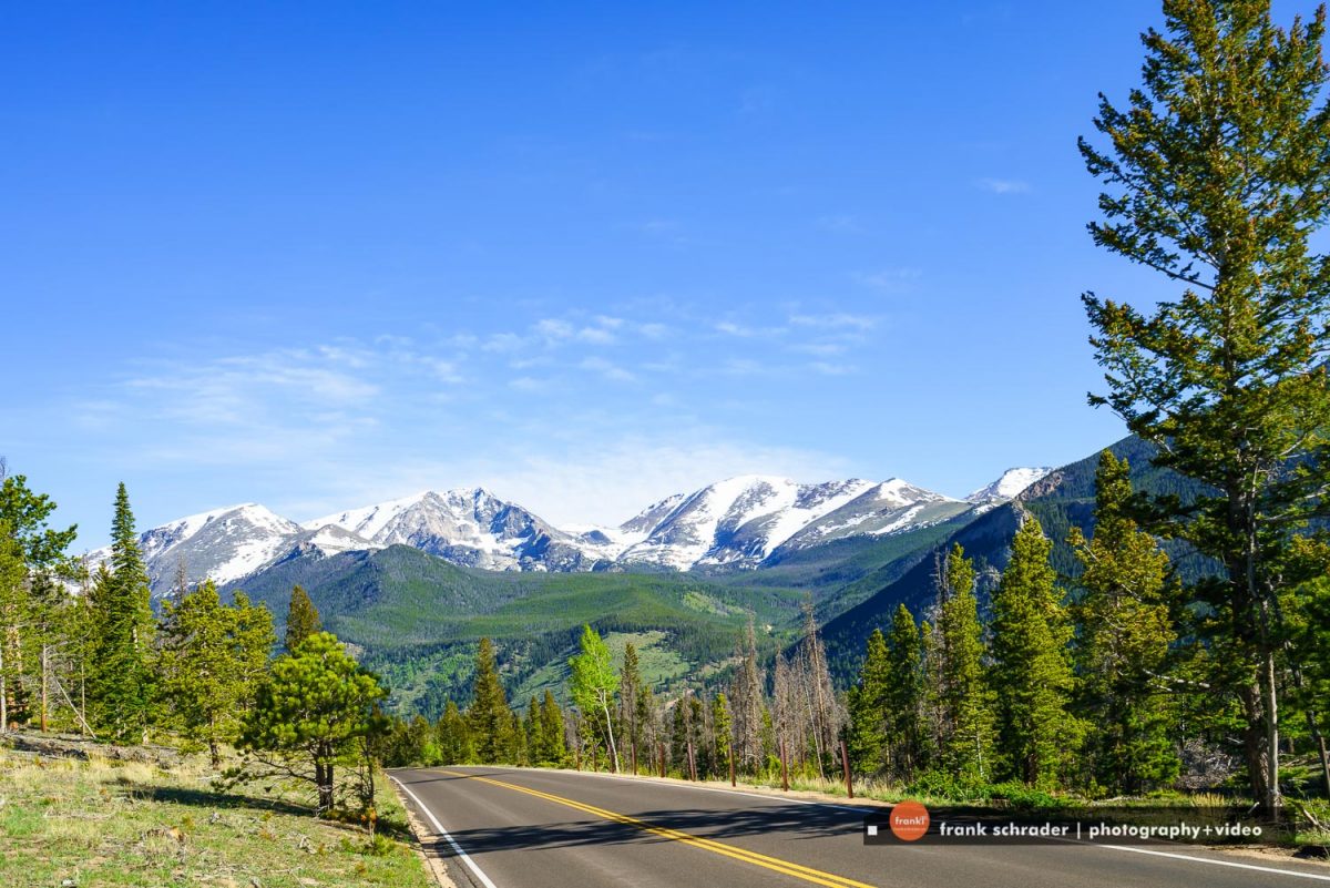
The road system of Rocky Mountain National Park offers visitors access to diverse ecosystems characterizing the higher regions of the central Rocky Mountains. The roads take visitors through lowland meadows and aspen groves, along swift-flowing rivers and up through subalpine forests to more than 12,000 feet in elevation. No other national park roads offer the dramatic experience of a long drive across alpine tundra region, and few offer such a wide variety of experiences.
The careful relationship of the park roads to the landscape results in a road system that generally harmonizes with the environment. Roadway alignments were chosen to highlight natural features, and scenic vistas and overlooks were provided to allow visitors to take in the magnificent terrain. The stone parapet walls and road-related structures, constructed in the National Park Service’s distinctive rustic style of architecture, relate well to their natural surroundings and help evoke a distinctive experience. Not surprisingly, the park roads are the principal attraction for most of the nearly three million visitors who flock to Rocky Mountain National Park each year.
Trail Ridge Road
Trail Ridge Road the the main park road for visitors, actually most visitors just drive that road and take stops wherever something scenic is to observe. Plenty of scenic lookouts are along the way. During the summer the road is heavily crowded and often no parking spots are available at the lookouts. Come early to Rocky Mountain National Park to escape the crowds!
Trail Ridge Road, Rocky Mountain National Park’s heavily traveled highway to the sky, inspired awe before the first motorist ever traveled it. “It is hard to describe what a sensation this new road is going to make,” predicted Horace Albright, director of the National Park Service, in 1931 during the road’s construction. “You will have the whole sweep of the Rockies before you in all directions.”
The next year, Rocky Mountain National Park’s lofty wilderness interior was introduced to the first travelers along an auto route the Rocky Mountain News called a “scenic wonder road of the world.”
Was all this just enthusiastic exaggeration? Hardly.
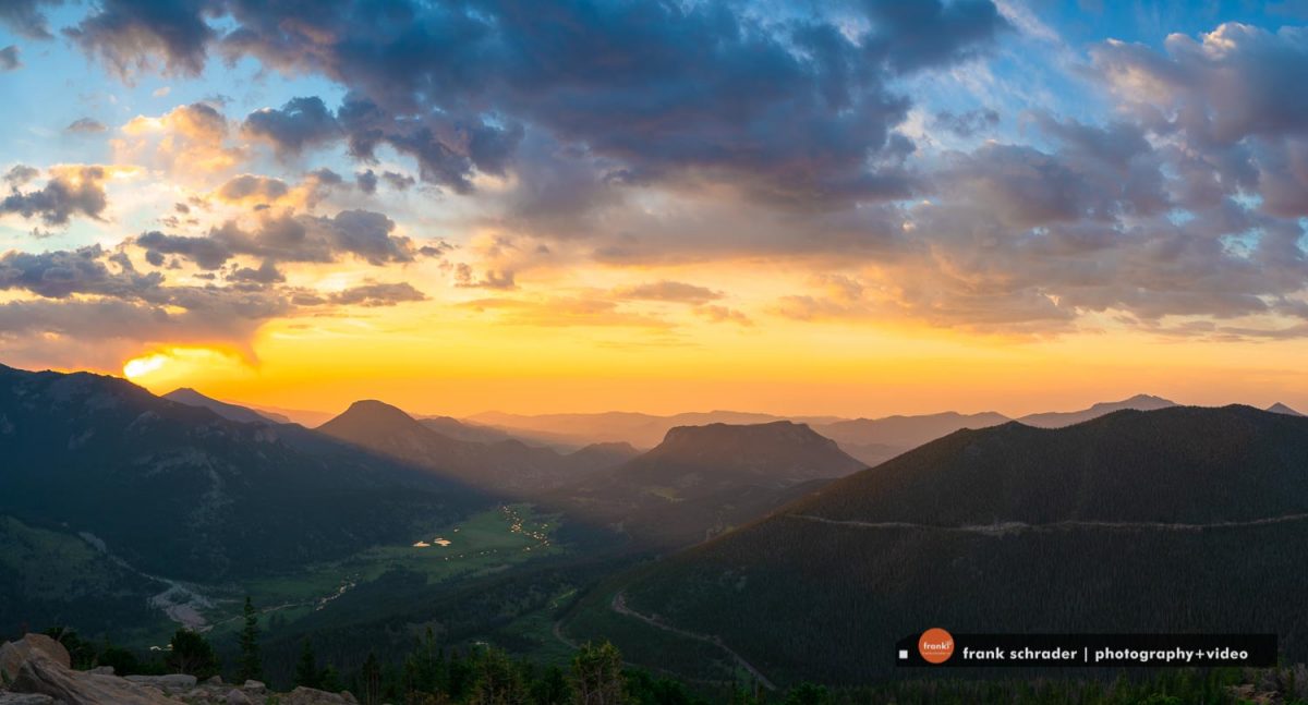
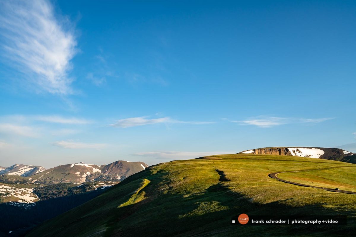
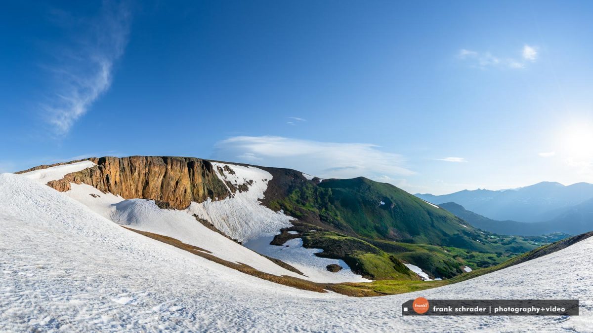
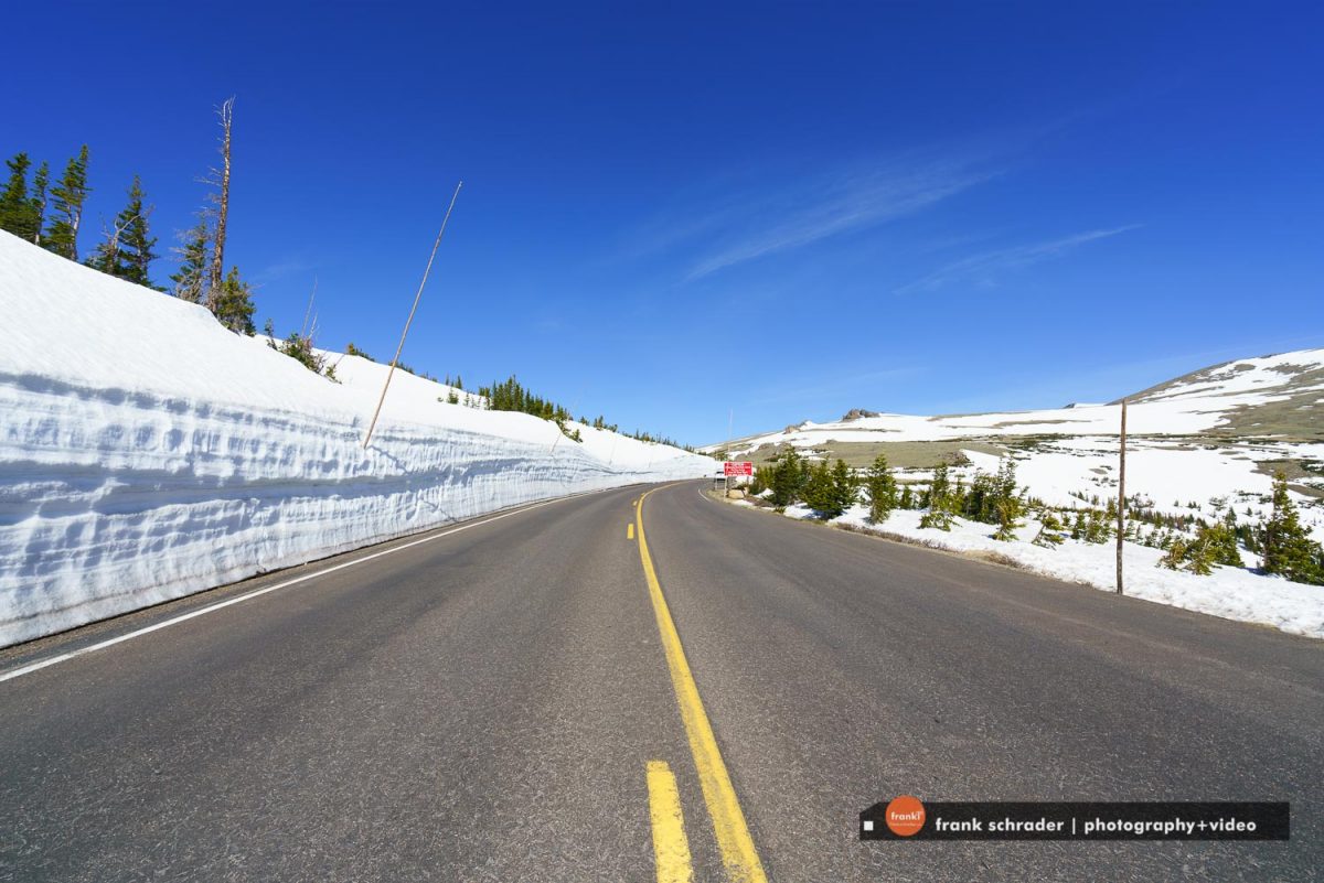
Covering the 48 miles between Estes Park on the park’s east side and Grand Lake on the west, Trail Ridge Road more than lives up to its advanced billing. Eleven miles of this high highway travel above tree-line, the elevation near 11,500 feet where the park’s evergreen forests come to a halt. As it winds across the tundra’s vastness to its high point at 12,183 feet elevation, Trail Ridge Road (U.S. 34) offers visitors thrilling views, wildlife sightings and spectacular alpine wildflower exhibitions, all from the comfort of their car.
Whether they begin their journey at Estes Park or Grand Lake, Trail Ridge Road travelers climb some 4,000 feet in a matter of minutes. The changes that occur en route are fascinating to observe. A drive that may begin in montane forests of aspen and ponderosa pine soon enters thick subalpine forests of fir and spruce. At treeline, the last stunted, wind-battered trees yield to the alpine tundra.
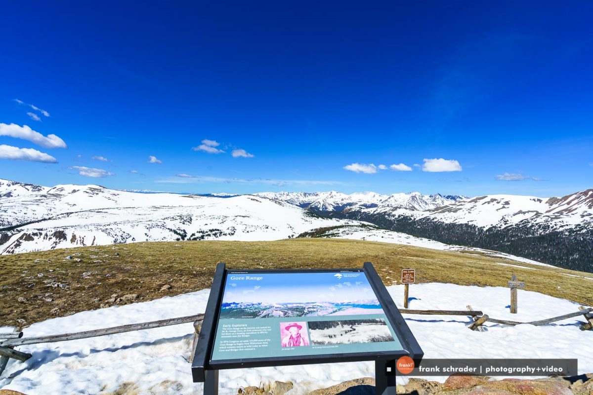
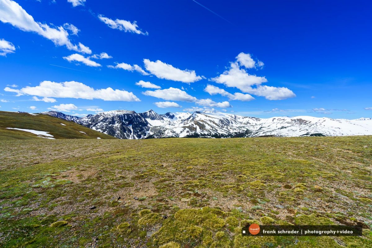
Up on that windswept alpine world, conditions resemble those found in the Canadian or Alaskan Arctic. It’s normally windy and 20 to 30 degrees colder than Estes Park or Grand Lake. The sun beats down with high- ultraviolet intensity. The vistas, best enjoyed from one of several marked road pullovers, are extravagant, sweeping north to Wyoming, east across the Front Range cities and Great Plains, south and west into the heart of the Rockies.
But for all its harshness, the Trail Ridge tundra is a place of vibrant life and vivid colors. Pikas, marmots, ptarmigans and bighorn sheep are commonly seen. About 200 species of tiny alpine plants hug the ground. Despite a growing season that may last just 40 days, many bloom exuberantly, adorning the green summer tundra with swatches of yellow, red, pink, blue, purple and white. All are seen from the Tundra World Nature Trail, a half- hour walk beginning near the parking area at Rock Cut.
Most Trail Ridge Road travelers drive to treeline with a certain amount of urgency. They are advised not to ignore all that awaits in the verdant country below the alpine tundra. Forested moraines, great heaps of earth and rock debris left behind by melting Ice Age glaciers, rise above lush mountain meadows. The Continental Divide, where streamflows are separated east from west, is crossed at Milner Pass, located at a surprisingly low 10,120 feet elevation. Moose munch greenery in the upper reaches of the Colorado River, which flows through the scenic Kawuneeche Valley. Grazing elk greet sunrise and sunset in many of the forest-rimmed meadows found around the park.
At all elevations, the drive on Trail Ridge Road is a memorable adventure. Put aside at least a half day for the trip. Longer, if possible. The experience, as Horace Albright suggested more than a half century ago, is hard to describe.
History of Trail Ridge Road
Construction on Trail Ridge Road began in September, 1929 and was completed to Fall River Pass July, 1932. Trail Ridge was built to counter deficiencies of Fall River Road. The Fall River route was too narrow for the increasing numbers of vehicles. Frequent snowslides, deep snow, and limited scenic views also plagued the route.
The maximum grade on Trail Ridge does not exceed 7%. Eight miles of the road are above 11,000 feet in elevation.
Old Fall River Road (our editorial tip !)
Completed in 1921, Old Fall River Road earned the distinction of being the first auto route in Rocky Mountain National Park offering access to the park’s high country. In the minds of many park visitors, the relatively subtle old route remains foremost. Unlike Trail Ridge Road, which is well known for being the highest continuous paved road in the nation, the Old Fall River Road is a much more “motor nature trail.”
Primarily gravel, one-way uphill and punctuated by switchbacks, slower-paced, 11-mile-long. The old road quietly leads travelers from Horseshoe Park (a short distance west of the Fall River Entrance) through the park’s wilderness to Fall River Pass, 11,796 feet above sea level. The journey to the alpine world at the top of Old Fall River Road is relaxing. The experience is one to be savored.
The posted speed limit is 15 miles per hour, a clear indication that a journey up Old Fall River Road is not for the impatient. The road itself is safe, but narrow and curved. In places, the trees of the montane and subalpine forests are so close that motorists can touch them. Old Fall River Road is ideal for visitors seeking to become intimate with nature.
The road follows a route traveled long ago by Indian hunters, who came to the park area in search of its abundant game. Early in the trip, travelers pass the alluvial fan scoured out by the 1982 Lawn Lake Flood and the site of a labor camp that housed state convicts who worked on the road project. For these men, crime did not pay. The laborers were forced to build the three-mile stretch of road to the scenic respite of Chasm Falls with no more than hand tools at their disposal.
After passing Willow Park, where elk often are seen feeding on the foliage, the road enters the alpine tundra. Awaiting there is the Fall River Cirque, birthplace of glaciers that once worked their way up and down the mountain valleys. The road traverses the headwall of this amphitheater-like formation before joining Trail Ridge Road near the Alpine Visitor Center at Fall River Pass.
Ahead lie the wonders of Trail Ridge Road, which leads travelers east to Estes Park or southwest to Grand Lake. Behind is Old Fall River Road, that winding old route that offers travelers a taste of auto travel in days gone by and a look at Rocky Mountain’s nature close-up.
Weather and Climate
The high country of Rocky Mountain National Park is noted for extreme weather patterns. Shaped by elevation, slope, and exposure, these patterns can change rapidly.
Annual Climate Conditions for Estes Park and Grand Lake
Temperatures are often moderate at elevations below 9,400′ (2,865 m). At higher points, like Bear Lake, Trail Ridge Road, or Longs Peak, it may snow even in July.
A wide variation between day and nighttime temperatures is also typical of mountain weather.
Summer days in July and August often reach the 70’s or 80’s and drop into the 40’s at night. All above temperatures given in Fahrenheit.
In Celsius that corresponds to: during summer temperatures usually stay under 30 degrees but can go above it. Night temperatures drop down to a little above freezing point.
Based on ten years of precipitation data, Estes Park receives approximately 13.10″ (33 cm) of moisture every year. Grand Lake receives about 19.95″ (50 cm) yearly. This precipitation comes in the form of rain or snowfall through the year.
Winter (December, January, February, March)
Lower elevations on the east slope of Rocky Mountain National Park are usually free of deep snow. At higher elevations, arctic conditions prevail. Sudden blizzards, high winds, and deep snowpack are common. The west side of the park experiences more snow, less wind, and clear cold days during these months. Most high country overnight trips require gear suitable for -35 degrees F (ca. -37 C) or below. Skiing and snowshoeing conditions are best in January, February, and March.
Spring (April and May)
Spring comes to the montane environs – elevations 8,000′ to 9,500′ (2,438 – 2,895 m) – in late April, although snowfall is not uncommon at this time of year. Unpredictable weather alternates between warm and cold, wet and dry. In June, spring is just reaching the subalpine country – 9,500′ to 11,500′ (2,895 – 3,505 m), while summer is on the plains. Wildflowers begin blooming at lower elevations in late April or early May. Many trails are still snow-covered. In late May, Trail Ridge Road opens for the season.
Summer (June, July, August)
On the alpine tundra — 11,500′ to 13,000′ (3,505 – 3,962 m) wildflowers bloom from late June to early August. Afternoon thunderstorms and wind are normal patterns. Always be prepared for temperature drops of 10-20 degrees Fahrenheit (5-10 degrees C).
Fall (September, October, November)
September and October bring clear, crisp air, blue skies, and generally dry weather. An early snowstorm may occur. Aspen leaves start changing colors in mid-September. Elk mating season begins in September and continues through most of October. Trail Ridge Road usually closes for the winter by mid-October.
More information about Rocky Mountain National Park in the following sections
Gorgeous Nature
150 lakes and 450 miles of streams are the basis of the riparian (wetland) ecosystem in the park. Lush plant life and dense wildlife are the hallmarks of these wet areas that speckle and divide other ecosystems.
Forests of pine and grassy hillsides dominate the montane ecosystem in the park. These areas may be drier than riparian areas but life still abounds. Look for critters leaping or creeping from tree to tree or poking their heads from underground.
As you gain elevation, you leave the montane areas and enter the subalpine ecosystem. The bent and gnarled bodies of spruce and fir trees tell the story of hard summers and harder winters near the mountain tops.
If you keep going up, you’ll emerge on the alpine tundra. This land is too harsh for trees and appears barren at first glance. But take a closer look. Nestled close to the ground is a dense carpet of plants and animals. Life persists even here in one of earth’s most extreme environments.
No matter what ecosystem you are in, you will be in the company of animals. Elk, mule deer, moose, bighorn sheep, coyotes, black bears, cougars and hundreds of smaller animals make a living in the park. Many visitors have been spellbound while watching the daily activities of the wildlife.
Underlying the bounty of life in the park is the literal foundation of the Rocky Mountains. The towering peaks and deep valleys are all composed of igneous (born of fire) and metamorphic rock. The same glaciers that sculpted the mountains have widened many valleys in the park.
One inescapable element of the park is the weather. Sunny summer mornings frequently give rise to formidable afternoon thunderstorms. Hold onto your hat during the snowy winter months when winds in the lowlands hit 60 miles per hour and wind-monitoring equipment in the highlands gets blown away.
The many aspects of the park are all inseparably interrelated. No matter what ‘ology’ interests you, Rocky Mountain National Park is a captivating place to study and enjoy.
Plants & Animals
The spectacular mountain scenery of the park is literally brought to life by the plants and animals that make their home here. Flowering plants, from the first pasque flower in April to the last aster in September, add color, fragrance, and movement to the landscape. Especially intriguing are the alpine wildflowers that survive the extreme climate of the tundra, completing their yearly life cycle in just a few weeks.
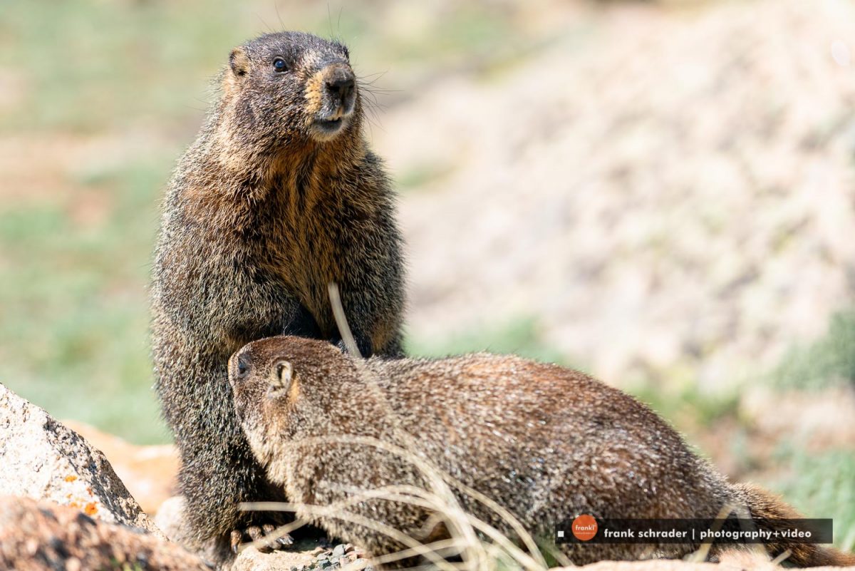
Although the park is most famous for its large animals, particularly elk and bighorn sheep, a glimpse of a tufted-eared Abert’s squirrel, an iridescent broad-tailed hummingbird, or a squeaking pika can be equally thrilling. Early risers, and those watching at dusk often have the best “luck” at seeing wildlife.
Wildlife Viewing
But there is much more to see than these so-called “charismatic megafauna.” Also found are nearly 60 other species of mammals; more than 280 recorded bird species; six amphibians, including the federally endangered boreal toad; one reptile (the harmless garter snake); 11 species of fish; and countless insects, including a surprisingly large number of butterflies.
Some basic knowledge of animal habits and habitats greatly enhances prospects of spotting Rocky Mountain’s wild residents.
A few park favorites:
Elk can be seen anytime, a popular viewing period being the fall rut, or mating season. Look for elk in meadows and where meadow and forest meet. Elk spend much of their time at or above tree-line during the summer, moving to lower elevations in the fall, winter and spring. Favorite feeding times: dawn and dusk.
Bighorn sheep are commonly seen at Sheep Lakes from May through mid-August.
Moose frequent willow thickets along the Colorado River in the Kawuneeche Valley on the park’s west side.
Otters were reintroduced into the Colorado River area and are doing fairly well. These animals are difficult to spot.
Mule deer are common and can be seen anywhere. They are most often found at lower elevations in open areas.
Bats feed over lakes and ponds at dawn and dusk.
Prime elk viewing areas include:
East:
- The meadows of Moraine Park
- Horseshoe Park
- Upper Beaver Meadows
West:
- Harbison Meadow
- Holzwarth Meadow
- Throughout the Kawuneeche Valley
Marmots and pikas favor rocky areas.
Marmots are best seen on the alpine tundra along Trail Ridge and Old Fall River roads.
Pikas – small, light-colored mammals – are common in rock piles. Listen for their sharp, distinctive bark and watch for movement.
Clark’s nutcrackers, Steller’s jays, golden eagles and prairie falcons can be seen along Trail Ridge Road.
White-tailed ptarmigans, some of the most sought-after birds in Rocky Mountain National Park, are common but difficult to spot. For best results, hike on the tundra and look carefully. Ptarmigans usually remain still, relying on their natural camouflage for protection. American dippers, or water ouzels, can be found along most streams. Listen for their loud call, similar to the rapid clicking of two stones together, as they fly up and down their territories.
Hiking
Throughout its 415 square miles of rock-ribbed wildness, Rocky Mountain National Park truly is a land of superlatives. Here, at least 60 mountains exceed 12,000 feet, topping off at 14,255 feet on the football field-sized summit of Longs Peak. Names such as Cirrus, Chiefs Head, Isolation, Mummy, and Storm evoke the grandeur of this high landscape.
Although the great peaks comprise the essence of the park, the delicate alpine flowers, clear lakes, rushing mountain waters, and impressive forests appeal to all the senses. An array of wildlife – bighorn sheep, ptarmigan, coyote, beaver – adds life to the landscape.
The wide variety of elevations and habitats create a choice of activities for visitors. From scenic dives and short strolls along a gentle trail to more ambitious daylong hikes to vertical mountain climbs, Rocky Mountain National Park offers many ways to experience nature in all its splendor.
Rocky Mountain National Park has 355 miles of hiking trails. These range from flat lakeside strolls to quite steep peak climbs. If you are new to the park, rangers at the visitor centers and backcountry office can provide advice on trails that are appropriate for different fitness and experience levels.
As you plan your hike, keep in mind that park elevations range from 7,500 to over 12,000 feet. Even very fit individuals coming from lower elevations may experience altitude problems. Symptoms include headaches, shortness of breath, insomnia, and rapid heartbeat. After a few days your body will have made some physiological adjustments to higher elevations, but full acclimation may take a weeks. To minimize symptoms drink plenty of fluids, avoid alcohol, don’t skip meals, and get plenty of rest.
Although you may not feel thirsty, the “thinner” air at high elevations actually results in increased water evaporation from your lungs. Again, drinking extra water may prevent a bad headache or other altitude symptoms.
Ultraviolet light is stronger in the mountains because there is less atmosphere for the sunlight to pass through. Wear sunscreen, a hat, sun glasses, and consider covering up with a long sleeved shirt if you are out in the sun for extended periods.
If you have never hiked before or are traveling with children, check out the recommended accessible trails. Ranger-led walks are free and can increase your confidence while you learn more about the park. Rocky Mountain National Park is a great place to discover how traveling by foot brings you closer to nature.
Although Rocky Mountain National Park is famous for its steep terrain, accessible trails have been constructed in areas noted for their scenery. These trails are also good choices for visitors interested in adjusting to the park’s higher elevations, groups that include young children, visitors with visual impairment and anyone who finds walking on level, relatively smooth paths attractive. Park trails meeting accessibility specifications include:
Coyote Valley Trail
Kawuneeche, the Arapaho word for coyote, was the name given to this gentle valley of the Upper Colorado River. Elk and moose are sometimes sighted from the one-mile trail, especially during the early morning and early evening hours.
Sprague Lake
Abner Sprague homesteaded in this area more than a century ago and created a trout pond by damming a stream. Sprague also undoubtedly appreciated the breathtaking views of the Continental Divide, which are best seen from this half-mile-long trail at the far end of the lake. An accessible backcountry camping site is located in the area.
Lily Lake
Enos Mills, the “father of Rocky Mountain National Park,” enjoyed walking to Lily Lake from his nearby cabin. Check along the mile-long trail through this relatively low-elevation area for wildflowers in the spring and early summer.
Bear Lake
Tucked into the spruce/fir forest at the base of Hallett Peak and Flattop Mountain, this 0.6-mile loop is one of Rocky’s most famous trails.Unlike other listed trails, Bear Lake is not entirely flat and is a more challenging route.
Continental Divide National Trail
The entire Continental Divide National Scenic Trail corridor is approximately 3,100 miles (4,988 km) long, extending from the Canadian border in Montana to the border of Mexico in New Mexico. About 1,900 miles (3,211 km) of the corridor contains existing trails or primitive routes. Considerable trip planning will be necessary to determine your specific route. The corridor varies from 4,000 feet (1,219 m) to over 13,000 feet (3,962m) elevation above sea level. Existing and proposed trails along the route traverse a variety of privately and publicly owned lands. The variety of situations encountered in the 3,100-mile corridor necessitate different land use and travel regulations and conditions.
In 1997 the route through Rocky Mountain National Park was adjusted and now consists of approximately 30 miles of spectacular scenery. In the park, the Continental Divide National Scenic Trail route does not entirely travel the actual Divide, however the most breathtaking section is above treeline, consisting of high peaks and fragile alpine tundra. Travel is through is in the montane and sub-alpine life systems at elevations of 8,000 (2,438 m) to 11,500 feet (3,505 m).
In north to south direction, the route enters the park on County Road 491. It then follows the River Trail north until it intersects with Trail Ridge Road (Highway 34) Near Green Mountain Trailhead. At this point the route follows the Green Mountain Trail east to the Tonahutu Creek Trail where it heads north and east to the junction of the North Inlet Trail. Here the route touches the actual continental divide at an elevation of 12,324. The North Inlet Trail is followed south and west to the town of Grand Lake. Once through Grand Lake, the route heads south along the East Shore Trail and exits the park at the south boundary. The route is entirely along existing, well-maintained trails.
Should you decide to travel the Continental Divide National Scenic Trail through the park for a few hours or several days, here are a few considerations:
The air is thin at these high altitudes between 10,500 feet (3,200 km) and 13,000 feet (3,962 km). Travel is slow and strenuous. Lightning danger accompanies early afternoon thunderstorms. Travel above treeline should be accomplished early in the day. Winter lasts about nine months on the Divide, from September through May. Arctic conditions prevail making travel extremely hazardous, if not impossible, during this season. Always practice Leave No Trace hiking and camping skills.
Park Information
Fees
All passes are available at all park entrance stations.
Editorial note: Note that Rocky Mountain National Park entrance fees are NOT valid 7-days like in most other National Parks in the United States.
1-Day Pass – Automobile – $25.00
Valid for date of purchase. Covers single, non-commercial vehicle with capacity of less than 16 passengers.
1-Day Pass – Per Person – $15.00
Valid for date of purchase. Applies to walk-ins, bicycles, and non-commercial groups.
1-Day Pass – Motorcycle – $25.00
Valid for date of purchase. Covers one motorcycle.
Official Website: https://www.nps.gov/romo/
Camping
Rocky Mountain National Park offers 5 campgrounds, 3 of them can be reserved. More details here: https://www.nps.gov/romo/planyourvisit/camping.htm
